
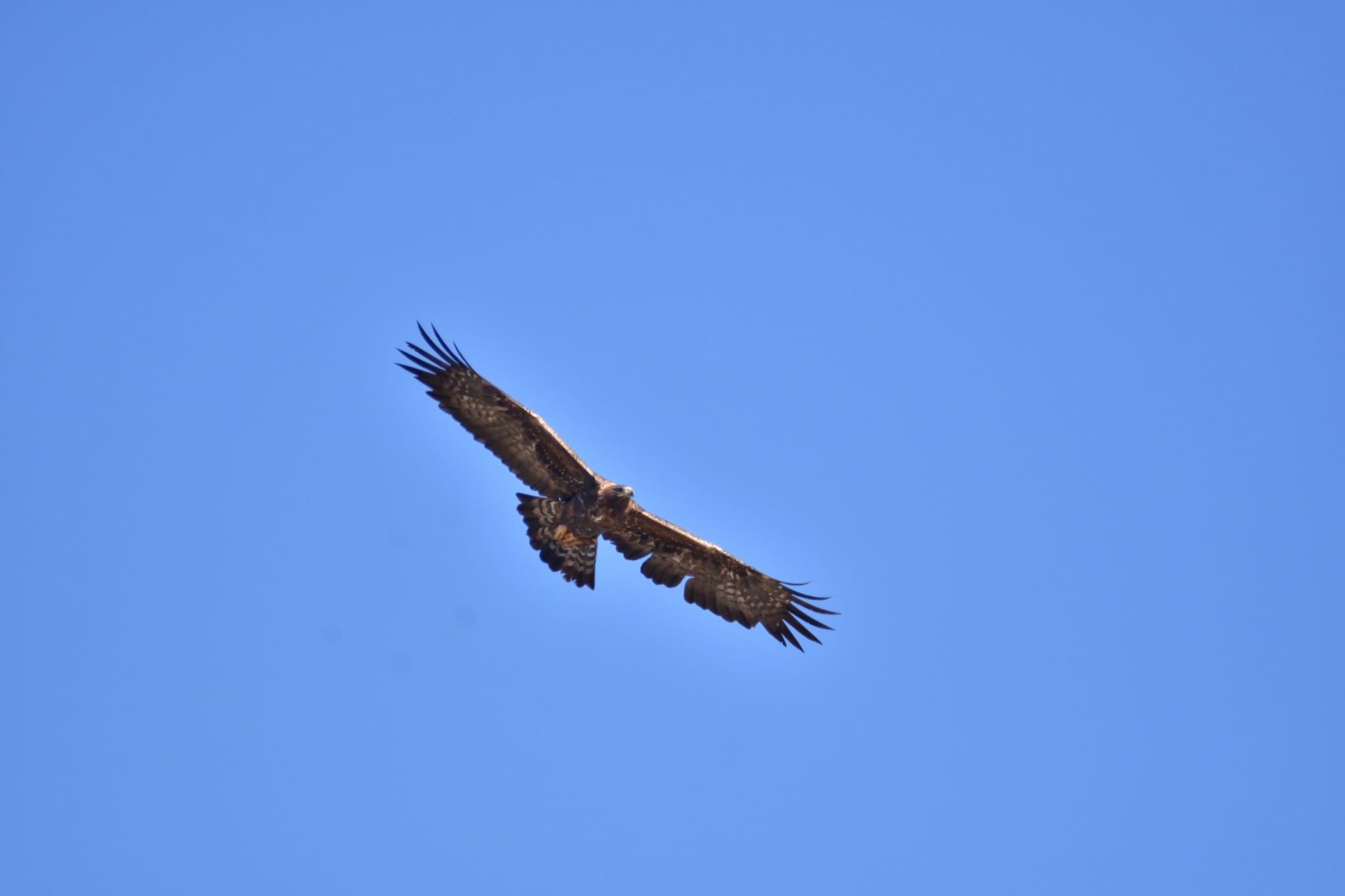
El funcionamiento de los ecosistemas influye en la aptitud de las especies en super predadores como el águila real
El cambio global está afectando gravemente el funcionamiento de los ecosistemas y la biodiversidad a nivel mundial. Los atributos funcionales de los ecosistemas (AFE) detectados remotamente son descriptores integradores del cambio ambiental y están estrechamente relacionados con los procesos que afectan directamente las cadenas alimentarias a través de las cascadas tróficas. Este estudio realizado en Galicia y puso él foco en el águila real, evalúa el éxito reproductivo en esta especie un depredador ápice en el nivel trófico superior, durante un período de 17 años a lo largo de un gradiente bioclimático.
Text in English after Spanish
Adrián Regos1, Luís Tapia1, Salvador Arenas-Castro2,3, Alberto Gil Carrera4,5 y Jesús Domínguez1
1Departamento de Zooloxı ́a, Xene ́tica e Antropoloxı ́a Fı ́sica, Universidade de Santiago de Compostela, 15782 Santiago de Com- postela, Spain; 2CIBIO-InBIO—Centro de Investiga ̧ca ̃ o em Biodiversidade e Recursos Gene ́ ticos, Laborato ́ rio Associado, Universidade do Porto, Campus Agra ́rio Vaira ̃o, 4485-661 Vila do Conde, Portugal; 3Instituto Polite ́cnico de Viana do Castelo, Escola Superior de Tecnologia e Gesta ̃o, 4900-347 Viana do Castelo, Portugal; 4GREFA (Grupo de Rehabilitacio ́n de la Fauna Auto ́ctona y su Ha ́bitat), Monte del Pilar S/N, Majadahonda, Madrid, Spain; 5EBX, Estacio ́n Biolo ́xica do Xure ́s, Vilamea ́, Lobios, Galicia, Spain.
El cambio global antropogénico está afectando gravemente el funcionamiento de los ecosistemas y la biodiversidad a nivel mundial (Flombaum et al. 2017; Rillig et al. 2019; Díaz et al. 2020). Un creciente cuerpo de trabajo ha demostrado cómo el calentamiento climático, el cambio en el uso de la tierra y sus efectos conjuntos han estado, directa o indirectamente, afectando la biodiversidad y el funcionamiento de los ecosistemas, con efectos secundarios difíciles de predecir en sus relaciones complejas y dinámicas (Carnicer et al 2011; Dib et al. 2020). Una mejor comprensión de las relaciones entre el funcionamiento de los ecosistemas y la biodiversidad en los diferentes niveles tróficos es esencial para ayudar a los administradores a responder adecuadamente a las amenazas que el cambio global representa para la biodiversidad y la salud de los ecosistemas (Thébault y Loreau 2006). También es fundamental desarrollar sistemas rentables de monitoreo y alerta temprana para responder proactivamente a estas amenazas con estrategias de gestión efectivas (Cabello et al. 2012; Anderson 2018; Aragón et al. 2019).
Los super depredadores se encuentran en la parte superior de la cadena alimentaria y desempeñan un papel fundamental en la dinámica de la población de los niveles tróficos inferiores (Wallach et al. 2015). Los efectos interactivos del calentamiento global del clima, los cambios regionales en el uso de la tierra y los regímenes alterados de perturbación pueden afectar de manera crítica la dinámica de la población de estas especies clave, con impactos posteriores en otros niveles tróficos a través de interacciones depredador-presa (Guiden et al., 2019). Hasta ahora, la mayoría de los estudios ecológicos sobre los superdepredadores se basan en enfoques de modelado respaldados por datos macroclimáticos (obtenidos de interpolaciones de estaciones meteorológicas) y características estáticas del hábitat (ver, por ejemplo, López-López et al. 2007; Tapia et al. 2007 ). A pesar de la creciente disponibilidad y calidad de los conjuntos de datos macroclimáticos, estos datos no pueden representar con precisión las condiciones microclimáticas a menudo impulsadas por los patrones topográficos y de vegetación local, y no logran capturar las características críticas de su nicho ecológico (Amiri et al. 2020). Estas limitaciones resaltan la necesidad de utilizar descriptores mas proximales de las condiciones de hábitat ‘reales’—en el sentido más amplio—que la especie está experimentando a nivel del suelo.
Es ampliamente aceptado que el balance energético y la productividad primaria neta afectan la riqueza
de especies locales porque cuanta más energía hay disponible, más biomasa por unidad de área se puede sustentar (Phillips et al. 2008; Brasil et al. 2019). Más biomasa permite que más individuos coexistan en un área, lo que potencialmente resulta en más energía disponible para la reproducción, lo que reduce las tasas de extinción (Connell y Orians 1964). Por lo tanto, la no inclusión de procesos ecosistémicos críticos cómo la productividad primaria o el balance energético superficial puede socavar nuestra capacidad para monitorear estas especies clave. Por ejemplo, recientemente se descubrió que la variabilidad temporal en la productividad primaria afecta las fluctuaciones de la calidad del hábitat y la dinámica de la metapoblación de las especies consumidoras al afectar los niveles de energía disponibles como recursos alimentarios (Fernández et al. 2016; Letnic et al. 2018). La fenología del hielo marino y los pulsos de productividad primaria dan forma al éxito reproductivo de las aves marinas del Ártico (Ramírez et al. 2017).
La disciplina de la teledetección ha evolucionado en gran medida durante las últimas décadas y actualmente permite monitorear y evaluar los componentes clave del funcionamiento de los ecosistemas (es decir, el flujo biogeoquímico de energía y materia dentro de los ecosistemas) (Lovett et al. 2006; Jax 2010; Van den Broeke et al. 2011; Lausch et al. 2016). A pesar de la creciente disponibilidad de descriptores de funciones ecosistémicas obtenidos mediante sensores remotos, su contribución potencial al monitoreo de especies en los niveles tróficos superiores sigue siendo poco estudiada. Entre otros, la temperatura de la superficie terrestre y el albedo, y estacional la productividad y la fenología son buenos descriptores de las funciones de los ecosistemas, siendo relativamente fáciles de obtener a partir de imágenes de teledetección (Metz et al. 2014; Zhao et al. 2018b; Aragón et al. 2019).
La temperatura de la superficie terrestre (LST) es un descriptor clave del balance de energía radiativa de la superficie de la Tierra (Hulley et al. 2019). La variación intra e interanual de este descriptor se usa a menudo como proxy de la dinámica del calor sensible (Li et al. 2013; Metz et al. 2014). Típicamente, la LST derivada de satélite se recupera estimando la radiancia emitida desde la superficie que se obtiene al corregir atmosféricamente la radiancia del sensor. LST mide la emisión de radiación térmica de la superficie terrestre donde la energía solar entrante interactúa y calienta el suelo, o la superficie del dosel en áreas con vegetación (Oyler et al. 2019). Por lo tanto, LST es un buen indicador de la partición de energía en el límite entre la superficie terrestre y la atmósfera y es especialmente sensible a las variaciones en el tipo de cobertura terrestre, la densidad de la vegetación o la humedad del suelo (Hulley et al. 2019). De hecho, la LST está determinada en gran medida por los gradientes climáticos y los patrones de productividad de la vegetación, y también está influenciada localmente por las condiciones topográficas y microclimáticas (Oyler et al. 2019). Además, las perturbaciones tanto naturales como antropogénicas (por ejemplo, incendios forestales) pueden ser otra fuente importante de variación espaciotemporal debido a cambios abruptos en los patrones de LST.
El albedo, definido cómo la radiación solar reflejada en la radiación solar entrante, es otro componente clave del funcionamiento del ecosistema relacionado con el balance de energía superficial. Puede medirse desde el espacio integrando información recuperada de sensores multibanda específicos basados en las propiedades de anisotropía definidas por funciones de distribución de reflectancia bidireccional. El albedo varía en grandes áreas debido a las variaciones en las propiedades de la superficie terrestre, como el tipo de cobertura terrestre, la cobertura de vegetación verde, la rugosidad de la superficie o la humedad del suelo. Por lo tanto, puede verse afectado por cambios en el uso de la tierra inducidos por el hombre y circuitos de retroalimentación del cambio climático (Hu et al., 2019). Además, la perturbación del fuego puede cambiar abruptamente la superficie terrestre con efectos duraderos en el albedo (Dintwe et al. 2017).
Este trabajo tiene como objetivo mejorar nuestra comprensión sobre cómo el funcionamiento de los ecosistemas influye en las especies clave en los niveles tróficos superiores aprovechando el gran potencial de la teledetección para rastrear los flujos de materia y energía desde el espacio. Esperamos que los atributos funcionales del ecosistema detectados remotamente (derivados de productos de detección remota como LST, Albedo y productividad de la vegetación) puedan, al menos, explicar parcialmente la aptitud ecológica de un superdepredador: el águila real. Para hacerlo, aprovechamos una base de datos de series temporales a largo plazo del éxito reproductivo del águila real durante un período de 17 años a través de un gradiente bioclimático. Computamos una base de datos integral de atributos funcionales del ecosistema a partir de tres productos satelitales MODIS (espectrorradiómetro de imágenes de resolución moderada) relacionados con el ciclo del carbono, la dinámica del calor y el balance radiativo. También evaluamos el posible retraso en la respuesta del águila real al fuego, un disruptor crítico del presupuesto de energía de superficie en nuestra región. El área de estudio es Galicia, región situada en el Noroeste de España (c. 29.575 km2 ) (Figura 1).

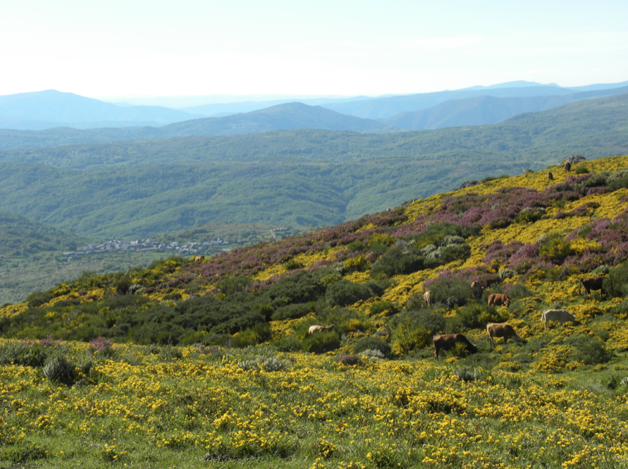
El clima es de transición entre atlántico y mediterráneo (Rodríguez Guitian y Ramil-Rego 2007; Rodríguez-Lado et al. 2016). Promedio la precipitación anual oscila entre 700 y 2000 mm, y la temperatura media anual entre 8,5 y 15 C (Rodríguez- Lado et al. 2016). Las altitudes son máximas (hasta 2071 msnm) en las montañas orientales y mínimas en la costa y valles fluviales. Las superficies forestales cubren más del 70% de la región de estudio, siendo actualmente una de las zonas más densamente arboladas de España. En las zonas de montaña, los sistemas agropastoriles tradicionales extensivos se han conservado hasta la actualidad, aunque han sido abandonados paulatinamente desde mediados del siglo XX, siendo recolonizados por bosques naturales y plantaciones de árboles de rápido crecimiento (Regos et al. 2015; Salaverri et al. 2018). El área de estudio está relativamente escasamente poblada, con algunas áreas grandes que tienen menos de 10 habitantes/km2 en las áreas montañosas del este. El régimen de incendios provocado por el hombre (incluidas las causas de negligencia e incendio provocado) expone el área de estudio a una frecuencia inusualmente alta de incendios forestales (Chas-Amil et al. 2010). Entre 1968 y 2016 se produjeron más de 256.000 incendios en Galicia, quemando más de 1.931.000 ha (ca el 63% del territorio) (Regos 2018).
El águila real es un super depredador, situado en el nivel superior de la cascada trófica. Esta rapaz puede describirse como depredador tanto generalista como oportunista, y se alimenta de una amplia variedad de especies en todo su rango de distribución mundial (Watson 2010; Bedrosian et al. 2017). Típicamente, esta especie se alimenta de mamíferos de tamaño mediano que oscilan entre 0,5 y 4,0 kg, aunque amplía su dieta cuando las especies de presa preferidas son escasas (Steenhof y Kochert 1988; Watson 2010).
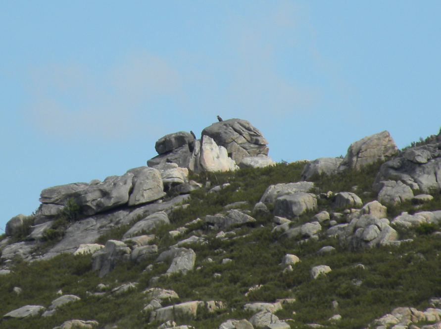
Un depredador ápice como el águila real tiene altos requerimientos de alimentos y energía, por lo que su rendimiento y aptitud ecológica, medidos por el éxito reproductivo, depende en gran medida de las fluctuaciones interanuales de la disponibilidad de presas, en su mayoría consumidores primarios, que a su vez dependen del balance energético de la superficie. dinámica y funcionalidad de los ecosistemas (Fernández et al. 2016; Preston et al. 2017). El área de estudio constituye el límite noroeste del área de distribución del águila real en la Península Ibérica, donde la especie se considera actualmente ‘Casi Amenazada’ (Madroño et al. 2005). En Galicia, el águila real tiene una población de 14 parejas reproductoras confirmadas, con otras 9 parejas compartidas con regiones vecinas del norte de Portugal y España (Gil-Carrera et al. 2016). Las áreas aptas para la anidación en el sitio de estudio se caracterizan por estar ubicadas en sierras entre 255 y 1443 msnm, cañones de ríos de fuertes pendientes, influencia climática mediterránea y zonas de baja presión humana (Lado y Tapia 2012). Los principales problemas de conservación están asociados con las limitaciones del hábitat, como el suministro inadecuado de alimentos, la escasa disponibilidad de sitios de anidación, la perturbación humana en las áreas de reproducción, como la electrocución y los cambios en el uso del suelo (Madroño et al. 2005; Tapia et al. 2007). Además, esta pequeña población habita una zona bioclimática de transición relativamente aislada de otros núcleos de la Península Ibérica (Tapia et al. 2007; Lado y Tapia 2012), y un aumento de la mortalidad puede tener un impacto importante en sus parámetros demográficos (Whitfield et al. 2004).
Para la realización de este trabajo, se han realizado campañas de reconocimiento de campo anuales (búsqueda a pie y en la carretera desde un vehículo 4 9 4) entre 2001 y 2017 en áreas aptas para la anidación con el fin de monitorear los territorios de reproducción conocidos y detectar nuevos (ver (Tapia et al. 2007, 2009; Gil y Tapia 2009) para detalles sobre el estudio de campo e inventario de los antiguos territorios de reproducción). La distribución del águila real en el área de estudio es bien conocida, siendo la tasa de pseudo-ausencias baja (N = 397 observaciones). El conjunto de datos final incluye 59 territorios de cría históricos y actualmente ocupados en Galicia y las regiones limítrofes (hasta 10 km de la frontera con Galicia). Estos 59 territorios de reproducción están ubicados en diferentes sistemas montañosos con condiciones geomorfológicas y bioclimáticas particulares (Figura 1). Caracterizamos el ámbito de hogar de cada pareja reproductora considerando radios de 5 km desde el nido (es decir, incluyendo el sitio del nido, las áreas de post-emplumamiento y alimentación; Tapia y Zuberogoitia 2018). Durante el período de 17 años, se registraron 168 parejas reproductoras en los 59 territorios, aunque solo se confirmaron 81. Algunas parejas reproductoras han cambiado sus nidos durante el período de estudio dentro del mismo territorio de reproducción. En estos casos, seleccionamos el punto central de ubicación del nido en cada territorio para el análisis.
Junto con la inmigración y la emigración, la natalidad y la mortalidad son los parámetros demográficos más importantes que determinan las tendencias de año a año en las poblaciones locales de rapaces (Steenhof y Newton 2007). En el presente estudio nos enfocamos en el éxito reproductivo para cada territorio y año de monitoreo. El éxito reproductivo se define como la proporción de parejas que anidan y ponen que crían crías hasta la edad de emplumar. Consideramos que las parejas tienen éxito cuando se observan crías bien desarrolladas en el nido en algún momento antes de emplumar. Los estudios que consideran que los nidos con crías de cualquier edad son exitosos tienden a sobreestimar el éxito del nido porque no consideran la mortalidad que puede ocurrir tarde en el período de crianza (Steenhof y Newton 2007).
Se seleccionaron tres productos satelitales MODIS (espectrorradiómetro de imágenes de resolución moderada) para describir tres dimensiones del funcionamiento del ecosistema: (1) índice de vegetación mejorado como sustituto de la dinámica del ciclo del carbono; (2) la temperatura de la superficie terrestre como sustituto de la dinámica del calor sensible; y (3) Albedo como sustituto del balance radiativo (Paruelo et al. 2001b; Cabello et al. 2012). Además, incluimos (4) Área quemada, como descriptor de la perturbación del fuego, que puede afectar dramáticamente estos tres descriptores biofísicos de las funciones del ecosistema (Bowman et al. 2009; Archibald et al. 2018). Los cuatro productos seleccionados por MODIS fueron:
- Índice de vegetación mejorado (EVI; MOD13Q1.006; 16 días L3 Global 250 m). El EVI es un descriptor de las ganancias de carbono, ya que se sabe que es más confiable en situaciones de cobertura vegetal alta y baja que el índice de vegetación de diferencia normalizada (NDVI), y resistente a las influencias del suelo, las señales de fondo del dosel y los efectos atmosféricos en el índice de vegetación. valores (Potter et al. 2007). Los valores de EVI oscilaron entre -1 y 1, y la vegetación saludable generalmente mantuvo valores entre 0,20 y 0,80.
- Temperatura de la superficie terrestre (LST; MOD11A2.006; 8 días L3 Global 1 km). LST es un buen descriptor del balance de energía en la superficie de la Tierra y uno de los parámetros clave en la física de los procesos de la superficie terrestre desde escalas regionales hasta globales. Además, LST está directamente relacionado con los regímenes ambientales primarios y con los atributos de calidad del hábitat (por ejemplo, productividad, estructura de la vegetación, tipo de cobertura del suelo; Cord y Rödder 2011). Las temperaturas (LST) oscilaron entre -25 C y 45 C.
- Albedo (ALB; MCD43A3.006; Daily L3 Global 500 m). ALB es un sustituto de las propiedades de la superficie, como la extensión y la naturaleza de la cubierta vegetal, y se ve afectado por el cambio de los factores biofísicos de la superficie terrestre, como la vegetación, la temperatura de la superficie terrestre y la humedad del suelo (Zhao et al. 2018a). Los valores de ALB oscilaron entre 0 y 1 (la nieve fresca y el suelo desnudo suelen caer alrededor de 0,9).
- Área Quemada (BA; colección 6 producto MODIS Área Quemada). BA es un buen descriptor de las interrupciones del presupuesto de energía de la superficie, ya que los incendios forestales representan un intercambio crítico de energía y materia entre la superficie y la atmósfera a través de la combustión (Bowman et al. 2009; Archibald et al. 2018). Los valores de BA oscilaron entre 0 y 1 (valores hasta 1 para aquellas áreas totalmente afectadas por el fuego).
Todos los predictores MODIS nativos y derivados se calcularon para el período de tiempo 2001–2017 con una resolución de 1 km y luego se agregaron (valores medios) en el nivel de búfer de 5 km mediante el uso de la plataforma computacional Google Earth Engine basada en la nube (https ://earthengine.google.com) (Gorelick y otros 2017). Para cada una de estas 3 dimensiones del funcionamiento del ecosistema (EVI, LST y ALB), derivamos las siguientes 7 métricas resumidas de su dinámica estacional: media anual (sustituto de la cantidad total anual); máximos y mínimos anuales (descriptores de los extremos anuales); desviación estándar estacional y coeficiente de variación (descriptores de estacionalidad); y fechas de máximo y mínimo (descriptores de fenología) (ver Tabla 1). El conjunto de datos completo incluía 21 descriptores del funcionamiento del ecosistema (7 métricas 9 3 dimensiones) como predictores candidatos en competencia. Cada uno de estos 21 atributos funcionales del ecosistema detectados remotamente se calcularon para cada año para medir la variabilidad interanual. Además, creamos variables que describen un lapso de tiempo en la respuesta del águila real al fuego. Para ello, estimamos el área quemada de cada año en cada zona de amortiguamiento de 5 km alrededor del nido. Luego, se crearon versiones retrasadas de la serie temporal cambiando el año en que ocurrió el evento de incendio (de 1 a 5 años después del evento de incendio).
Para evaluar el efecto del funcionamiento del ecosistema en el éxito reproductivo del águila real, realizamos modelos de exposición logística de supervivencia del nido (Brown et al. 2013) mediante el uso de modelos lineales generalizados de efectos mixtos (GLMM; Bolker et al. 2009) con paquetes R ‘lmer4’ (Bates et al. 2014).
Estos modelos de supervivencia del nido de exposición logística son similares a los modelos de regresión logística en que la variable de respuesta es binomial (éxito o fracaso reproductivo), pero la función de enlace se modifica del enlace logit para considerar los días de exposición del nido (Shaffer 2004)—101 días para el águila real (ver Brown et al. 2013 y referencias allí). Los GLMM se utilizaron para dar cuenta de la estructura jerárquica del conjunto de datos de especies, en el que cada conjunto de datos subyacente cubre una temporada de reproducción diferente (es decir, un año) en cada sistema montañoso (Bolker et al. 2009; Harrison et al. 2018). Incluimos los descriptores de detección remota de las funciones del ecosistema como factores fijos y ‘año’ y ‘sistema montañoso’ como efectos aleatorios anidados. Sobre la base de esta estructura de efectos aleatorios, el componente de efectos fijos se modificó mediante la función ‘dredge’ disponible en el paquete R ‘MuMIn’ para ejecutar la selección de modelos automatizada con subconjuntos de todas las combinaciones (válidas) de variables explicativas (Barton 2016). Calculamos cada modelo delta AIC (DAIC) para verificar la fuerza de la evidencia a favor de cada modelo. Los valores de Delta AIC por debajo de 4 sugieren evidencia sustancial para el modelo (Burnham y Anderson 2002; Arnold 2010). Se calculó un modelo final promedio a partir de aquellos con DAIC por debajo de 4 mediante el uso de la función ‘model.avg’ disponible en el paquete R ‘MuMIn’. La importancia de cada predictor se obtuvo sumando los pesos de Akaike (Wi) a los modelos en los que está presente esa variable (Burnham y Anderson 2002; Arnold 2010).
Para evitar incluir variables altamente correlacionadas en ajuste del modelo, eliminamos las variables de detección remota con los coeficientes de correlación de Pearson anteriores 0,7 o inferior – 0,7 y factor de inflación variable mayor que 3. Por lo tanto, a partir del conjunto de datos inicial de 21 Atributos funcionales del ecosistema detectados remotamente, solo retuvimos 12 variables no correlacionadas relacionadas con
el ciclo del carbono (4 variables del tiempo EVI serie), dinámica del calor sensible (4 variables de
serie temporal LST) y balance de radiancia (4 variables de la serie de tiempo de Albedo).
Los resultados se obtienen en base al análisis del éxito reproductor del águila real durante 17 años en Galicia. Los modelos que presentaban mayor serán aquellos que incluían variables relacionadas con el ciclo de carbono en el ecosistema, el cual está relacionado con la productividad vegetal. Si los modelos se obtienen incluyendo variables funcionales del ecosistema, en especial las variables relacionadas con el balance energético superficial), también presentan una buena respuesta y predicción, algo inferior que los modelos basados en la productividad vegetal. El modelo integrador (incluyendo todas las variables anteriores), muestra un buen rendimiento. Si se incluyen variables como la alteración del hábitat, más concretamente el efecto de los incendios transcurridos 3 años, se incrementaría el éxito en las predicciones de los modelos.
Nuestro estudio proporciona evidencia de la influencia de el ecosistema funcionando en la aptitud de un vértice depredador (es decir, un depredador en el nivel trófico superior). Desde el conjunto de datos inicial de 12 de forma remota descriptores funcionales del ecosistema detectados, 4 de ellos (la desviación estándar y la media anual de LST, la media anual de EVI y la fecha del mínimo Albedo) afectaron el desempeño reproductivo de esta población residual de Águila Real en el NW de Iberia en los últimos 17 años. Perturbación de fuego también afectó la aptitud ecológica de este depredador ápice, pero con un efecto positivo limitado a los 3 años después del incendio (es decir, una respuesta retardada en el tiempo a la energía superficial interrupciones presupuestarias). A pesar de la moderada capacidad predictiva de nuestros modelos (valores AUC desde 0,71 a 0,8), debemos ser conscientes de la conocida relevancia de otros factores abióticos y bióticos, que no se incluyen aquí—que determinan el éxito reproductivo de este super depredador (como la presión humana o los brotes de la enfermedad de los conejos).
La desviación estándar del LST intraanual dinámica—un descriptor del calor estacional dinámica: afectó positivamente el sistema reproductivo comportamiento de la especie (ver Figura 2 y Tabla 2). De acuerdo con nuestros resultados, cuanto mayor sea la variación interanual en LST, mayor es la probabilidad de éxito reproductivo. Este patrón podría explicarse por el marcado gradiente bioclimático de nuestra área de estudio, en la transición entre las regiones Eurosiberiana y Mediterránea (Rodríguez Guitian y Ramil-Rego 2007). Los territorios de cría han sido tradicionalmente más productiva en la parte oriental de nuestra región (Gil y Tapia 2009; Lado y Tapia 2012), caracterizada por una mayor variación climática intraanual (es decir, veranos secos e inviernos templados y húmedos) que la zona atlántica eurosiberiana (caracterizada por un clima húmedo moderado por la influencia de el océano, con inviernos fríos y ausencia de una estación seca diferenciada). Esta correlación entre la variación estacional en LST y el reproductivo el rendimiento también se puede explicar por la altitud y gradientes topográficos, desde el Golden Eagle tiende a ocupar y reproducirse en áreas montañosas en salientes de acantilados con influencia climática mediterránea (Tapia et al. 2007; Lado y Tapia 2012), caracterizada por fuertes gradientes térmicos. En Además, una gran variación interanual en LST fue observado en los últimos 17 años en nuestra región, debido probablemente al efecto conjunto de fluctuaciones climáticas interanuales y disturbios por incendios (Goetz et al. 2007; Ueyama et al. 2014). Por lo tanto, las retroalimentaciones positivas entre el calentamiento climático y el aumento de la perturbación por incendios podrían favorecer el desempeño reproductivo de la especie en las próximas décadas en nuestra región, como se pronosticó anteriormente para otras águilas en España (Muñoz et al., 2013).
La media anual de LST fue otro descriptor relevante de la dinámica del calor estacional para explicar el éxito reproductivo del águila real. Cuanto mayor sea la media anual de LST, menor será la probabilidad de éxito reproductivo A pesar de la preferencia de esta población por áreas con influencia climática mediterránea (es decir, con temperaturas de verano más altas que las áreas más atlánticas), se encontró que la supervivencia de la cría del águila real en nidos expuestos disminuyó a medida que aumentaba el número de días con temperatura máxima de al menos 32,2 C. aumentó (Steenhof et al. 1997; Kochert et al. 2019). Nuestros resultados confirman que la temperatura de la superficie puede ser un factor limitante para el rendimiento reproductivo del águila real.
Se encontró que la media anual de la serie de tiempo EVI, un sustituto de la productividad de la vegetación, influye negativamente en el desempeño reproductivo del águila real. Por lo tanto, cuanto menor sea la productividad de la vegetación, mayor será la probabilidad de éxito reproductivo. Aunque está ampliamente aceptado que tasas de productividad primaria más altas permiten una mayor disponibilidad de energía para la reproducción (Connell y Orians 1964; Brasil et al. 2019), las áreas con productividad primaria baja en los territorios de reproducción del águila real generalmente se asocian con hábitats abiertos con escasamente áreas con vegetación, que indirectamente podrían mostrar las áreas de caza cercanas a los sitios de reproducción. Las áreas de matorral abierto son seleccionadas positivamente por el águila real como hábitats de caza porque la estructura de la vegetación favorece la detección de presas y el éxito de la caza (Tapia et al. 2007; Lado y Tapia 2012). Mas carroña alimentada por el águila real es frecuente cuando la presa natural es escasa (Watson 2010), y esta rapaz habita en zonas montañosas de ganadería en libertad en la región de estudio (Tapia et al. 2007). De hecho, las áreas abiertas dominado por matorrales bajos y pastizales también representan el hábitat típico seleccionado por los más presas comunes en la Península Ibérica: conejo de monte europeo (Oryctolagus cuniculus), liebre ibérica (Lepus granatensis) y perdiz roja (Alectoris rufa) (Tapia y Domínguez 2007; Tapia et al. 2010, 2014; Watson 2010). Investigaciones anteriores ya han demostrado que la la dinámica interanual de la productividad primaria afecta los patrones de colonización y ocupación del hábitat dinámica de los consumidores primarios y secundarios (Requena-Mullor et al. 2014; Fernández et al. 2016). Cambios interanuales en productividad primaria impulsada, por ejemplo, por fluctuaciones climáticas o procesos de sucesión natural así como los cambios abruptos causados por los incendios forestales podrían por lo tanto, impactan significativamente el desempeño de la especie.
La fecha del albedo mínimo en la temporada de crecimiento, un descriptor de la radiación neta en las superficies terrestres, se asoció con una menor probabilidad de éxito reproductivo del águila real. Como se mencionó anteriormente, las águilas suelen seleccionar los salientes de los acantilados para anidar (López-López et al. 2007; Tapia et al. 2007). Los sitios de anidación generalmente se encuentran en terrenos accidentados a gran altura en suelos desnudos con cubiertas vegetales bajas. Estas áreas están expuestas a altas temperaturas superficiales y bajas tasas de productividad primaria, lo que se traduce en altos valores de albedo. Por lo tanto, se encontró que la menor probabilidad de éxito reproductivo está asociada con la fecha en que los valores de albedo son mínimos en la temporada de crecimiento (es decir, los valores mas altos de productividad primaria). El cambio de uso del suelo se reconoce como uno de los principales factores que impulsan la dinámica del albedo superficial (ver, por ejemplo, Zhai et al. 2015; Hu et al. 2019). Sin embargo, la perturbación del fuego, que implica un intercambio crítico de energía y materia entre la tierra y la atmósfera, también puede afectar el balance de energía de la superficie al reducir inicialmente el albedo de la superficie (Gatebe et al. 2014) antes de recuperarse (a diferentes velocidades dependiendo del tiempo transcurrido desde el incendio y después del incendio Lyons et al. 2008; Gatebe et al. 2014; Dintwe et al. 2017; Torres et al. 2018) a sus condiciones de albedo previas al incendio. De hecho, nuestro estudio señala una respuesta con un retraso de 3 años del águila real a perturbaciones del presupuesto de energía superficial causadas por incendios forestales durante el período de 17 años Estudios previos en la España mediterránea mostraron que el conejo de campo y otras especies de presas potenciales colonizaron progresivamente las áreas quemadas (Moreno y Villafuerte 1995; Tapia et al. 2010, 2014), donde sus la abundancia aumentó durante al menos 5 años después del incendio (Rollan y Real 2011).El efecto de los incendios forestales en el estado físico del águila real se puede explicar por su impacto conjunto en el variación espacio-temporal de LST, productividad de la vegetación y albedo.
En conclusión, el desempeño reproductivo de el águila real, un depredador ápice en la parte superior nivel trófico—está influenciado por el funcionamiento del ecosistema. remotamente descriptores funcionales del ecosistema detectados, como el desviación estándar de LST (como sustituto de la dinámica del calor estacional), media anual de EVI (sustituto de la productividad primaria) y la fecha de mínimo albedo en la temporada de crecimiento (sustituto de net radiación en la superficie terrestre) se encontró que eran factores relevantes que afectan su aptitud ecológica en una amplia zona de transición bioclimática en el sur de Europa. La perturbación del fuego también afectó la ecología. aptitud de este depredador del ápice al afectar potencialmente disponibilidad de hábitat de las especies en los niveles tróficos más bajos, con un efecto positivo limitado a los 3 años después fuego (es decir, una respuesta retardada en el tiempo a las interrupciones del presupuesto de energía de la superficie). Nuestro estudio confirma la utilidad potencial al considerar el asunto y flujos de energía entre la superficie terrestre y la atmósfera para explicar el éxito reproductivo de las especies en los niveles tróficos superiores. Aunque localmente factores medidos como la abundancia de presas y Se sabe que la ubicación geográfica del nido es buena predictores del éxito reproductivo, anual en el campo.
Ecosystem Functioning Influences Species apex predators like the Golden Eagle
Global change is severely affecting ecosystem functioning and biodiversity globally. Remotely sensed ecosystem functional attributes (EFAs) are integrative descriptors of the environmental change—being closely related to the processes directly affecting food chains via trophic cascades This study carried out in Galicia focused on the golden eagle, evaluating the reproductive success of this species, an apex predator at the upper trophic level, over a period of 17 years along a bioclimatic gradient. This study carried out in Galicia and focused on the Golden Eagle, evaluates the reproductive success of this species, an apex predator at the upper trophic level, over a period of 17 years along a bioclimatic gradient.
Anthropogenic global change is severely affecting ecosystem functioning and biodiversity globally (Flombaum et al. 2017; Rillig and others 2019; Díaz et al. 2020). A growing body of work has shown how climate warming, land-use change and their joint effects have been—directly or indirectly—affecting biodiversity and ecosystem functioning, with difficult-to-predict side effects on their complex and dynamic relationships (Carnicer et al. 2011; Dib et al. 2020). A better understanding of the ecosystem functioning-bio- diversity relationships at the different trophic levels is essential to help managers adequately respond to the threats that global change poses to biodiversity and ecosystem health (Thébault and Loreau 2006). It is also critical to develop cost-effective monitor- ing and early warning systems to proactively respond to these threats with effective management strategies (Cabello et al. 2012; Anderson 2018; Aragón et al. 2019).
Apex predators are at the top of food chain, playing a critical role in the population dynamics of lower trophic levels (Wallach et al. 2015). The interactive effects of global climate warming, regional land-use changes and altered disturbance regimes can critically affect the population dynamics of these keystone species, with subsequent impacts on other trophic levels through predator–prey interactions (Guiden et al. 2019). Until now, most ecological studies on apex predators are based upon modelling approaches supported by macroclimate data (obtained from interpolations of meteorological stations) and static habitat features (see for example, López-López et al. 2007; Tapia et al. 2007). Despite the increasing availability and quality of macroclimate datasets, these data cannot accurately represent the microclimatic conditions often driven by topo- graphic and local vegetation patterns—failing to capture critical features of their ecological niche (Amiri et al. 2020). These limitations highlight the need of using more proximal descriptors of the ‘real’ habitat conditions—in the broadest sense—that the species is experiencing at the ground level.
It is widely accepted that energy balance and net primary productivity affects local species richness because the more energy that is available, the more biomass per unit area that can be supported (Phillips et al. 2008; Brasil et al. 2019). More biomass enables more individuals to coexist in an area, potentially resulting in more energy available for reproduction, lowering extinction rates (Connell & Orians 1964). Thus, the non-inclusion of critical ecosystem processes such as primary productivity or surface energy balance can undermine our capacity to monitor these keystone species. For instance, the temporal variability in primary pro- ductivity was recently found to affect habitat- quality fluctuations and meta-population dynamics of consumer species by affecting the energy levels available as food resources (Fernández et al. 2016; Letnic et al. 2018). Sea ice phenology and primary productivity pulses shape breeding success in Artic seabirds (Ramí́rez et al. 2017).
The remote sensing discipline has largely evolved over the last decades, currently allowing monitoring of and assessing key components of ecosystem functioning (that is, the biogeochemical flow of energy and matter within ecosystems) (Lovett et al. 2006; Jax 2010; Van den Broeke et al. 2011; Lausch et al. 2016). Despite the increasing availability of remotely sensed descriptors of ecosystem functions, their potential contribution to the monitoring of species at upper trophic levels remains poorly studied. Among others, land surface temperature and albedo, and seasonal productivity and phenology are good descriptors of ecosystem functions—being relatively easy to obtain from remote sensing images (Metz et al. 2014; Zhao et al. 2018b; Aragón et al. 2019).
Land Surface Temperature (LST) is a key descriptor of the radiative energy budget of the Earth’s surface (Hulley et al. 2019). The intra and interannual variation of this descriptor is often used as proxy for sensible heat dynamics (Li et al. 2013; Metz et al. 2014). Satellite-de- rived LST is typically retrieved by estimating the surface-emitted radiance that is obtained by atmospherically correcting the at-sensor radiance. LST measures the emission of thermal radiance from the land surface where the incoming solar energy interacts with and heats the ground, or the surface of the canopy in vegetated areas (Oyler et al. 2019). LST is therefore a good indicator of energy partitioning at the land surface-atmosphere boundary and especially sensitive to variations in land-cover type, vegetation density or soil moisture (Hulley et al. 2019). In fact, LST is largely shaped by climatic gradients and vegetation productivity patterns, being also locally influenced by topographic and microclimatic conditions (Oyler et al. 2019). In addition, both natural and anthropogenic disturbances (for example, wildfires) can be another important source of spatiotemporal variation due to abrupt changes in LST patterns.
Albedo, defined as the reflected solar radiation to the incoming solar radiation, is another key component of ecosystem functioning related to surface energy balance. It can be measured from space by integrating information retrieved from specific multiband sensors based on the anisotropy properties defined by bidirectional reflectance distribution functions. Albedo varies over large areas due to variations in land surface properties such as land cover type, green vegetation cover, surface roughness or soil moisture. It can be therefore affected by human-induced land-use changes and climate change feedback loops (Hu et al. 2019). In addition, fire disturbance can abruptly change land surface with long-standing effects on albedo (Dintwe et al. 2017).
This work aims to improve our understanding on how ecosystem functioning influence keystone species at upper trophic levels by leveraging the great potential of remote sensing to track matter and energy fluxes from space. We expect that remotely sensed ecosystem functional attributes (derived from remote sensing products such as LST, Albedo and vegetation productivity) can—at least—partially explain the ecological fitness of an apex predator—the Golden Eagle. To do so, we took advantage of a long-term time series database of the reproductive success of the Golden Eagle over a 17-year period across a bioclimatic gradient. We computed a comprehensive database of ecosystem functional attributes from three MODIS (Moderate Resolution Imaging Spectroradiometer) satellite-products related to the carbon cycle, heat dynamics and radiative balance. We also assessed possible time-lag in the response of the Golden Eagle to fire, a critical disruptor of the surface energy budget in our region.
The study area is Galicia, region located in the Northwestern Spain (c. 29,575 km2) (Figure 1). The climate is transitional between Atlantic and Mediterranean (Rodríguez Guitián and Ramil-Rego 2007; Rodríguez-Lado et al. 2016). Average annual rainfall ranges between 700 and 2000 mm, and annual mean temperature between 8.5 and 15 °C (Rodríguez-Lado and others Rodríguez- Lado). Altitudes are maximal (up to 2071 m.a.s.l.) in the eastern mountains and minimal in the coast and fluvial valleys. Forest areas cover over 70% of the study region, being currently one of the most densely forested areas of Spain. In mountain areas, extensive traditional agropastoral systems have been preserved until today, although they have gradually been abandoned since the mid twentieth century, being recolonized by natural forests and fast-growing tree plantations (Regos and others 2015; Salaverri et al. 2018). The study area is relatively sparsely populated, with some large areas having less than 10 inhabitants/km2 in the eastern mountainous areas. Human-driven fire regime (including negligence and arson causes) exposes the study area to an unusually high frequency of wildfires (Chas-Amil et al. 2010). Between 1968 and 2016, more than 256,000 fires took place in Galicia, burning more than 1,931,000 ha (c.a. 63% of the territory) (Regos 2018).
The Golden Eagle is an apex predator, placed at the upper level of the trophic cascade. This raptor can be described as both generalist and opportunistic predator, feeding on a wide variety of species across its worldwide distribution range (Watson 2010; Bedrosian et al. 2017). Typically, this species feeds on medium-sized mammals ranging from 0.5 to 4.0 kg, although it expands its diet when preferred prey species are scarce (Steenhof and Kochert 1988; Watson 2010). An apex predator such us the Golden Eagle have high food and energy requirements so its performance and ecological fitness, measured by the reproductive success, strongly depends on interannual fluctuations of prey availability—mostly primary consumers—which in turn depend on surface energy balance dynamics and ecosystem functionality (Fernández et al. 2016; Preston et al. 2017). The study area constitutes the Northwestern border of the Golden Eagle’s distribution range in the Iberian Peninsula, where species is considered currently ‘Near Threatened’ (Madroño et al. 2005). In Galicia, the Golden Eagle has a population of 14 confirmed breeding pairs, with other 9 pairs shared with neighbouring regions of northern Portugal and Spain (Gil-Carrera et al. 2016). Suitable areas for nesting in the study site are characterized by being located in mountain ranges between 255 and 1443 m.a.s.l., river canyons of steep slopes, Mediterranean climatic influence and low human pressure areas (Lado and Tapia 2012). The main conservation problems are associated with habitat limitations such as inadequate food- supply, poor availability of nesting sites, human disturbance in breeding areas such as electrocution and land-use changes (Madroño et al. 2005; Tapia et al. 2007). Moreover, this small population inhabits a transitional bioclimatic area relatively isolated from other nuclei of the Iberian Peninsula (Tapia et al. 2007; Lado and Tapia 2012), and an increase in mortality can have a major impact on its demographic parameters (Whitfield et al. 2004).
Annual field survey campaigns (foot and road searching from a 4 9 4 vehicle) have been conducted between 2001 and 2017 on areas suitable for nesting in order to monitor the known breeding territories and detect new ones (see (Tapia et al. 2007, 2009; Gil and Tapia 2009) for details on the field survey and inventory of the former breeding territories). The distribution of the Golden Eagle in the study area is well known, being the rate of pseudo-absences low (N = 397 observations). The final dataset includes 59 historical and currently occupied breeding territories in Galicia and the neighbouring regions (up to 10 km from the Galician border). These 59 breeding territories are located across different mountain systems with particular geomorphological and bioclimatic conditions (Figure 1). We characterized the home range of each breeding pair by considering radii of 5 km from the nest (that is, including the nest site, post-fledging and foraging areas; Tapia and Zuberogoitia 2018). Over the 17-year period, 168 breeding pairs were recorded in the 59 territories, although only 81 were confirmed. Some breeding pairs have changed their nests during the study period within the same breeding territory. In these cases, we selected the central point of nest location in each territory for the analysis.
Together with immigration and emigration, natality and mortality are the most important demographic parameters that determine the year- to-year trends in raptor local populations (Steenhof and Newton 2007). In the present study, we focused on the reproductive success for each territory and year of monitoring. Reproductive success is defined as the proportion of nesting and laying pairs that raise young to the age of fledging. We consider pairs to be successful when well-grown young are observed in the nest at some point prior to fledging. Studies that consider nests with young of any age to be successful tends to overestimate nest success because they fail to consider mortality that may occur late in the brood-rearing period (Steenhof and Newton 2007).
Three MODIS (Moderate Resolution Imaging Spectroradiometer) satellite-products were selected to describe three dimensions of ecosystem functioning: (1) Enhanced Vegetation Index as a surrogate for the carbon cycle dynamics; (2) Land Surface Temperature as a surrogate of sensible heat dynamics; and (3) Albedo as a surrogate for the radiative balance (Paruelo and others 2001b; Ca- bello and others 2012). In addition, we included (4) Burnt Area, as a descriptor of fire disturbance—which can dramatically affect these three biophysical descriptors of ecosystem functions (Bowman and others 2009; Archibald and others 2018). The four MODIS selected products were:
- Enhanced Vegetation Index (EVI; MOD13Q1.006; 16-Day L3 Global 250 m). EVI is an descriptor of carbon gains since it is known to be more reliable in both low and high vegetation cover situations than Normalized Difference Vegetation Index (NDVI), and resistant to both soil influences, canopy background signals, and atmospheric effects on vegetation index values (Potter et al. 2007). EVI values ranged from -1 to 1, with healthy vegetation generally holding values between 0.20 and 0.80.
- Land Surface Temperature (LST; MOD11A2.006; 8-Day L3 Global 1 km). LST is a good descriptor of the energy balance at the Earth’s surface, and one of the key parameters in the physics of land-surface processes from regional to global scales. In addition, LST is directly linked to the primary environmental regimes and to habitat quality attributes (for example, productivity, vegetation structure, land cover type; Cord and Rödder 2011). Temperatures (LST) ranged from -25 °C to 45 °C.
- Albedo (ALB; MCD43A3.006; Daily L3 Global 500 m). ALB is surrogate for surface properties such as the extent and nature of the vegetation cover, and it is affected by the change of the land surface biophysical factors such as vegetation, land surface temperature and soil moisture (Zhao et al. 2018a). ALB values ranged from 0 to 1 (fresh snow and bare soil usually fall around 0.9).
- Burnt Area (BA; Collection 6 MODIS Burned Area product). BA is a good descriptor of the surface energy budget disruptions since wildfires represent a critical exchange of energy and matter between the surface and the atmosphere via combustion (Bowman et al. 2009; Archibald et al. 2018). BA values ranged from 0 to 1 (values up to 1 for those areas totally affected by fire).
All native, and derived, MODIS predictors were computed for the 2001–2017 time period at 1-km resolution and then aggregated (mean values) at the 5-km buffer level by using the cloud-based Google Earth Engine computational platform (https://earthengine.google.com) (Gorelick and others 2017). For each of these 3 dimensions of ecosystem functioning (EVI, LST and ALB), we derived the following 7 summary metrics of their seasonal dynamics: annual mean (surrogate of annual total amount); annual maximum and minimum (descriptors of the annual extremes); seasonal standard deviation and coefficient of variation (descriptors of seasonality); and dates of maximum and minimum (descriptors of phenology). The complete dataset included 21 descriptors of ecosystem functioning (7 metrics 9 3 dimensions) as competing candidate predictors. Each of these 21 remotely sensed ecosystem functional attributes were then computed for each year to measure the interannual variability. In addition, we created variables describing a time-lag in the response of the Golden Eagle to fire. To do so, we estimated the burnt area of each year in each 5-km buffer around the nest. Then, lagged versions of the time series were created by shifting the year in which the fire event took place (from 1 to 5 years after a fire event).
To evaluate the effect of ecosystem functioning on reproductive success of the Golden Eagle, we performed logistic-exposure models of nest survival (Brown et al. 2013) by using generalized linear mixed-effects models (GLMMs; Bolker et al. 2009) with R packages ‘lmer4’ (Bates et al. 2014).
These logistic-exposure nest survival models are similar to logistic regression models in that the re- sponse variable is binomial (breeding success or failure), but the link function is modified from the logit link to consider nest exposure days (Shaffer 2004)—101 days for the Golden eagle (see Brown and others 2013 and references therein). GLMMs were used to account for the hierarchical structure of the species dataset, whereby each underlying dataset covers a different breeding season (that is, year) in each mountain system (Bolker et al. 2009; Harrison et al. 2018). We included the remotely sensed descriptors of ecosystem functions as fixed factors and ‘year’ and ‘mountain system’ as nested random effects. Based on this random effect structure, the fixed effect component was then modified using the ‘dredge’ function available from the R package ‘MuMIn’ to run automated model selection with subsets of all (valid) combinations of explanatory variables (Barton 2016). We calculated each model delta AIC (DAIC) to verify the strength of evidence in favour of each model. Delta AIC values below 4 suggest substantial evidence for the model (Burnham and Anderson 2002; Arnold 2010). An average final model was computed from those with DAIC below 4 by using the ‘model.avg’ function available from the R package ‘MuMIn’. The importance of each predictor was obtained by adding the Akaike weights (Wi) to the models in which that variable is present (Burnham and Anderson 2002; Arnold 2010).
To avoid including highly correlated variables in model fitting, we removed remotely sensed variables with Pearson’s correlation coefficients above 0.7 or below – 0.7 and Variable Inflation Factor greater than 3. Thus, from the initial dataset of 21 remotely sensed ecosystem functional attributes, we only retained 12 non-correlated variables related with carbon cycle (4 variables from EVI time series), sensitive heat dynamics (4 variables from LST time series) and radiance balance (4 variables from Albedo time series).
The results were successfully obtained based on the analysis of the golden eagle breeder during 17 years in Galicia. The models that presented the highest will be those that emerged variables related to the carbon cycle in the ecosystem, which is related to plant productivity. If the models are obtained including functional variables of the ecosystem, especially the variables related to the surface energy balance), they also present a good response and prediction, somewhat lower than the models based on plant productivity. The integrating model (including all the previous variables), shows a good performance. If variables such as the evolution of the habitat are included, more specifically the effect of the fires after 3 years, the success in the predictions of the models would be increased.
Our study provides evidence for the influence of the ecosystem functioning on the fitness of an apex predator (that is, a predator at the upper trophic level). From the initial dataset of 12 remotely sensed ecosystem functional descriptors, 4 of them (the standard deviation and annual mean of LST, the annual mean of EVI and the date of the minimum Albedo) were found to affect the reproductive performance of this residual population of Golden Eagle in NW Iberia over the last 17 years. Fire disturbance also affected ecological fitness of this apex predator, but with a limited positive effect at 3 years after fire (that is, a time-lagged response to surface energy budget disruptions). Despite the moderate predictive capacity of our models (AUC values from 0.71 to 0.8), we must be aware of the well-known relevance of other abiotic and biotic factors—which are not included here—that determine the reproductive success of this apex predator (such as human pressure or outbreaks of rabbit disease).
The standard deviation of the intra-annual LST dynamics—a descriptor of the seasonal heat dynamics—positively affected the reproductive performance of the species. According to our results, the higher the interannual variation in LST, the higher the probability of reproductive success. This pattern might be explained by the marked bioclimatic gradient of our study area, in the transition between the Eurosiberian and Mediterranean regions (Rodríguez Guitián and Ramil-Rego 2007). The breeding territories have been traditionally more productive in the eastern part of our region (Gil and Tapia 2009; Lado and Tapia 2012), characterized by stronger intra annual climatic variation (that is, dry summers and mild, wet winters) than the Eurosiberian Atlantic zone (characterized by a humid climate moderated by the influence of the ocean, with cold winters and the lack of a distinct dry season). This correlation between the seasonal variation in LST and the reproductive performance can be also explained by altitudinal and topographic gradients, since the Golden Eagle tends to occupy and breed in mountainous areas on cliff ledges with Mediterranean climatic influence (Tapia et al. 2007; Lado and Tapia 2012), characterized by strong thermal gradients. In addition, a large interannual variation in LST was observed over the last 17 years in our region, due likely to the joint effect of interannual climate fluctuations and fire disturbance (Goetz et al. 2007; Ueyama et al. 2014). Thus, positive feedbacks between climate warming and increased fire disturbance could favour reproductive performance of the species over the upcoming decades in our region, as previously forecasted for other eagles in Spain (Muñoz et al. 2013).
The annual mean of LST was another relevant descriptor of the seasonal heat dynamics to explain the breeding success of the Golden Eagle. The higher the annual mean of LST, the lower the probability of reproductive success. Despite the preference of this population for areas with Mediterranean climatic influence (that is, with higher summer temperatures than more Atlantic areas), the Golden Eagle brood survival in exposed nests was found to decline as the number of days with maximum temperature at least 32.2 °C increased (Steenhof et al. 1997; Kochert et al. 2019). Our results confirm that surface temperature can be a limiting factor for the reproductive performance of the Golden Eagle.
The annual mean of LST was another relevant descriptor of the seasonal heat dynamics to explain the breeding success of the Golden Eagle. The higher the annual mean of LST, the lower the probability of reproductive success. Despite the preference of this population for areas with Mediterranean climatic influence (that is, with higher summer temperatures than more Atlantic areas), the Golden Eagle brood survival in exposed nests was found to decline as the number of days with maximum temperature at least 32.2 °C increased (Steenhof et al. 1997; Kochert et al. 2019). Our results confirm that surface temperature can be a limiting factor for the reproductive performance of the Golden Eagle.
The annual mean of EVI time series—a surrogate of vegetation productivity—was found to negatively influence the reproductive performance of the Golden Eagle. Thereby, the lower the vegetation productivity, the higher the probability of breeding success. Although it is widely accepted that higher primary productivity rates enables more energy available for reproduction (Connell and Orians 1964; Brasil et al. 2019), areas with low primary productivity in the breeding territories of the Golden Eagle are usually associated with open habitats with sparsely vegetated areas—which might indirectly inform about hunting areas close to the breeding sites. Open shrubland areas are positively selected by the Golden Eagle as hunting habitats because the vegetation structure favours prey detection and hunting success (Tapia et al. 2007; Lado and Tapia 2012). Further carrion feeding by the Golden Eagle is frequent when natural prey is scarce (Watson 2010), and this raptor lives in free-range mountainous areas of livestock farming in the study region (Tapia et al. 2007). In fact, open areas dominated by low scrublands and pastures also represent the typical habitat selected by the more common prey species in the Iberian Peninsula: European Wild Rabbit (Oryctolagus cuniculus), Iberian Hare (Lepus granatensis) and Red-legged Partridge (Alectoris rufa) (Tapia and Domínguez 2007; Tapia a et al. 2010, 2014; Watson 2010). Previous research have already showed that the interannual dynamics in primary productivity affect habitat colonization patterns and occupancy dynamics of both primary and secondary consumers (Requena-Mullor et al. 2014; Fernández et al. 2016). Interannual changes in primary productivity driven by, for instance, climatic fluctuations or natural succession processes as well as abrupt changes caused by wildfires might therefore significatively impact the species’ performance.
The date of the minimum albedo in the growing season—a descriptor of the net radiation on land surfaces—was associated with lower probability of breeding success of the Golden Eagle (Table 2 and Figure 2). As mentioned above, cliff ledges are often selected by the eagles for nesting (López-López and others 2007; Tapia and others 2007). Nesting sites are usually located in rugged terrains at high altitudes on bare soils with low vegetation covers. These areas are exposed to high surface temperatures and low primary productivity rates, which translates into high albedo values. Thus, lower probability of breeding success was found to be associated with the date when albedo values are minimum in the growing season (that is, highest values of primary productivity). Land-use change is recognized as one of the major factors driving sur- face albedo dynamics (see for example, Zhai and others 2015; Hu and others 2019). However, fire disturbance—that involves a critical exchange of energy and matter between land and atmosphere—can also affects surface energy balance by initially reducing surface albedo (Gatebe and others 2014) before recovering (at different rates depending on time since fire and post-fire vegetation recovery (Lyons and others 2008; Gatebe and others 2014; Dintwe and others 2017; Torres and others 2018) to their prefire albedo conditions. In fact, our study points out to a 3-year time-lagged response of Golden Eagle to surface energy budget disruptions caused by wildfires over the 17-year time period. Previous studies in Mediterranean Spain showed that European wild rabbit and other potential prey species progressively colonized burnt areas (Moreno and Villafuerte 1995; Tapia and others 2010, 2014), where their abundance increased for at least 5 years after the fire (Rollan and Real 2011). The effect of wildfires on Golden Eagle’s fitness can be explained by their joint impact on the spatiotemporal variation of LST, vegetation productivity and albedo.
In conclusion, the reproductive performance of the Golden Eagle—an apex predator at the upper trophic level—is influenced by ecosystem functioning. Remotely sensed ecosystem functional descriptors such as the standard deviation of LST (as surrogate of the seasonal heat dynamics), annual mean EVI (surrogate of primary productivity) and the date of minimum albedo in the growing season (surrogate of net radiation on land surfaces) were found to be relevant factors affecting its ecological fitness in a wide bioclimatic transition area in southern Europe. Fire disturbance also affected ecological fitness of this apex predator by potentially affecting habitat availability of species at lower trophic levels—with a limited positive effect at 3 years after fire (that is, a time-lagged response to surface energy budget disruptions). Our study confirms the potential usefulness in considering the matter and energy fluxes between land surface and atmosphere to explain the reproductive success of species at the upper trophic levels. Although locally measured factors such as prey abundance and geographic nest location are known to be good predictors of breeding success, annual infield.
Bibliografia / Citing Literature
Anderson CB. 2018. Biodiversity monitoring, earth observations and the ecology of scale. Ecology Letters 21:1572–1585.
Amiri M, Tarkesh M, Jafari R, Jetschke G. 2020. Bioclimatic variables from precipitation and temperature records vs. re- mote sensing-based bioclimatic variables: Which side can perform better in species distribution modeling? Ecological Informatics 57:101060. https://doi.org/10.1016/j.ecoinf.2020. 101060
Aragón P, Sánchez-Fernández D, Hernando C. 2019. Use of satellite images to characterize the spatio-temporal dynamics of primary productivity in hotspots of endemic Iberian but- terflies. Ecological Indicators 106:105449. https://doi.org/10. 1016/j.ecolind.2019.105449.
Arnold TW. 2010. Uninformative Parameters and Model Selec- tion Using Akaike’s Information Criterion. Journal of Wildlife Management 74:1175–1178.
Bedrosian G, Watson JW, Steenhof K, Kochert MN, Preston CR, Woodbridge B, Williams GE, Keller KR, Crandall RH. 2017. Spatial and Temporal Patterns in Golden Eagle Diets in the Western United States, with Implications for Conservation Planning. Journal of Raptor Research 51:347–367.
Bates D, Maechler M, Bolker B, Walker S. 2014. lme4: Linear Mixed-effects Models Using Eigen and S4. R Package Version 1.1–23. :Available from: https://cran.r-project.org/web/pac.
Barton K. 2016. MuMIn: multi-model inference. R package version 1.15.6. :https:// CRAN.R-project.org/pack- age=MuMIn.
Burnham KP, Anderson DR. 2002. Model Selection and Multi- model Inference: a Practical Information-theoretic Approach. New York: Springer.
Bolker BM, Brooks ME, Clark CJ, Geange SW, Poulsen JR, Stevens MHH, White J-SS. 2009. Generalized linear mixed models: a practical guide for ecology and evolution. Trends in ecology & evolution 24:127–35. http://www.ncbi.nlm.nih.go v/pubmed/19185386. Last accessed 17/07/2011
Brasil LS, Silverio DV, Cabette HSR, Batista JD, Vieira TB, Dias- Silva K, de Oliveira-Junior JMB, de Carvalho FG, Calva ̃o LB, Macedo MN, Juen L. 2019. Net primary productivity and seasonality of temperature and precipitation are predictors of the species richness of the Damselflies in the Amazon. Basic and Applied Ecology 35:45–53. https://doi.org/10.1016/j.baa e.2019.01.001.
Brown JL, Steenhof K, Kochert MN, Bond L. 2013. Estimating raptor nesting success: Old and new approaches. Journal of Wildlife Management 77:1067–1074.
Cabello J, Fernández N, Alcaraz-Segura D, Oyonarte C, Piñeiro G, Altesor A, Delibes M, Paruelo JM. 2012. The ecosystem functioning dimension in conservation: Insights from remote sensing. Biodiversity and Conservation 21:3287–3305.
Carnicer J, Coll M, Ninyerola M, Pons X, Sa ́ nchez G, Pen ̃ uelas J. 2011. Widespread crown condition decline, food web dis- ruption, and amplified tree mortality with increased climate change-type drought. Proceedings of the National Academy of Sciences of the United States of America 108:1474–8. http:// http://www.pubmedcentral.nih.gov/articlerender.fcgi?artid=302972 5&tool=pmcentrez&rendertype=abstract. Last accessed 26/05/ 2013.
Chas-Amil ML, Touza J, Prestemon JP. 2010. Spatial distribution of human-caused forest fires in Galicia (NW Spain). In: Perona G, Brebbia CA, editors. Modelling, Monitoring and Manage- ment of Forest Fires II. pp 247–58. http://www.cabdirect.org.a re.uab.cat/abstracts/20103231465.html;jsessionid=2F9CE64 F227317271368B4D4EF557C3C
Connell JH, Orians E. 1964. The ecological regulation of species diversity. American Naturalist 111:1119–1144.
Díaz S, Settele J, Brondízio E, Ngo H, Guèze M, Agard J, Arneth A, Balvanera P, Brauman K, Butchart S, Chan K, Garibaldi L, Ichii K, Liu J, Subrmanian S, Midgley G, Miloslavich P, Molnár Z, Obura D, Pfaff A, Polasky S, Purvis A, Razzaque J, Reyers B, Chowdhury R, Shin Y, Visseren-Hamakers I, Wilis K, Zayas C. 2020. Summary for policymakers of the global assessment report on biodiversity and ecosystem services of the Intergovernmental Science-Policy Platform on Biodiver- sity and Ecosystem Services. https://www.ipbes.net/sites/defa ult/files/downloads/spm_unedited_advance_for_posting_htn. pdf .
Dintwe K, Okin GS, Xue Y. 2017. Fire-induced albedo change and surface radiative forcing in sub-Saharan Africa savanna ecosystems: Implications for the energy balance. Journal of Geophysical Research 122:6186–6201.
Dib V, Pires APF, Casa Nova C, Bozelli RL, Farjalla VF. 2020. Biodiversity-mediated effects on ecosystem functioning depend on the type and intensity of environmental disturbances. Oikos 129:433–443.
Fernández N, Román J, Delibes M. 2016. Variability in primary productivity determines metapopulation dynamics. Proceedings of the Royal Society B: Biological Sciences 283.
Flombaum P, Yahdjian L, Sala OE. 2017. Global-change drivers of ecosystem functioning modulated by natural variability and saturating responses. Global Change Biology 23:503–511.
Gatebe CK, Ichoku CM, Poudyal R, Roma ́ n MO, Wilcox E. 2014. Surface albedo darkening from wildfires in northern sub-Saharan Africa. Environmental Research Letters 9.
Gil A, Tapia L. 2009. El Águila real en Galicia. In: Del Moral JC, editor. Águila real en España. Población reproductora en 2008 y método de censo. SEO/Birdlife, Madrid. pp 114–21.
Goetz SJ, MacK MC, Gurney KR, Randerson JT, Houghton RA. 2007. Ecosystem responses to recent climate change and fire disturbance at northern high latitudes: Observations and model results contrasting northern Eurasia and North Amer- ica. Environmental Research Letters 2.
Guiden PW, Bartel SL, Byer NW, Shipley AA, Orrock JL. 2019. Predator-Prey Interactions in the Anthropocene: Reconciling Multiple Aspects of Novelty. Trends in Ecology and Evolution 34:616–627. https://doi.org/10.1016/j.tree.2019.02.017.
Harrison XA, Donaldson L, Correa-Cano ME, Evans J, Fisher DN, Goodwin CED, Robinson BS, Hodgson DJ, Inger R. 2018. A brief introduction to mixed effects modelling and multi-model inference in ecology. PeerJ 2018:1–32.
Hu Y, Hou M, Zhao C, Zhen X, Yao L, Xu Y. 2019. Human- induced changes of surface albedo in Northern China from 1992–2012. International Journal of Applied Earth Observa- tion and Geoinformation 79:184–191. https://doi.org/10.101 6/j.jag.2019.03.018.
Hulley GC, Ghent D, Go ̈ttsche FM, Guillevic PC, Mildrexler DJ, Coll C. 2019. Land Surface Temperature.
Jax K. 2010. Ecosystem functioning. Cambridge University Press.
Kochert MN, Steenhof K, Brown JL. 2019. Effects of Nest Exposure and Spring Temperatures on Golden Eagle Brood Survival: An Opportunity for Mitigation. Journal of Raptor Research 53:91–97. https://doi.org/10.3356/JRR-17-100.
Lausch A, Bannehr L, Beckmann M, Boehm C, Feilhauer H, Hacker JM, Heurich M, Jung A, Klenke R, Neumann C, Pause M, Rocchini D, Schaepman ME, Schmidtlein S, Schulz K, Selsam P, Settele J, Skidmore AK, Cord AF. 2016. Linking Earth Observation and taxonomic, structural and functional biodiversity: Local to ecosystem perspectives. Ecological Indi- cators 70:317–339. https://doi.org/10.1016/j.ecolind.2016.06. 022.
Letnic M, Ripple WJ. 2017. Large-scale responses of herbivore prey to canid predators and primary productivity. Global Ecology and Biogeography 26:860–866.
Li ZL, Tang BH, Wu H, Ren H, Yan G, Wan Z, Trigo IF, Sobrino JA. 2013. Satellite-derived land surface temperature: Current status and perspectives. Remote Sensing of Environment 131:14–37. https://doi.org/10.1016/j.rse.2012.12.008.
Lado LR, Tapia L. 2012. Suitable breeding habitat for Golden Eagle (Aquila chrysaetos) in a border of distribution area in Northwestern Spain: Advantages of using remote sensing information vs. Land Use Maps. Viet Et Milieu 62:77–85.
López-López P, García-Ripollé s C, Soutullo A ́ , Cadahía L, Urios V. 2007. Identifying potentially suitable nesting habitat for golden eagles applied to ‘important bird areas’ design. Animal Conservation 10:208–218.
Lovett GM, Jones CG, Turner MG, Weathers KC. 2006. Ecosystem Function in Heterogeneous Landscapes. (Lovett, C. G. Jones, M. G. Turner and K. C. Weathers E, editor.). Springer, New York.: Springer, New York.
Madroño A, González C, Atienza JC. 2005. Libro Rojo de las Aves de España. Madrid.: Dirección General para la Biodiversidad-SEO Birdlife.
Metz M, Rocchini D, Neteler M. 2014. Surface Temperatures at the Continental Scale: Tracking Changes with Remote Sensing at Unprecedented Detail. Remote Sensing 6:3822–40. http:// http://www.mdpi.com/2072-4292/6/5/3822/. Last accessed 29/04/ 2014.
Moreno S, Villafuerte R. 1995. Traditional management of scrubland for the conservation of rabbits Oryctolagus cuniculus and their predators in Don ̃ ana National Park, Spain. Biological Conservation 73:81–85.
Muñoz A-R, Márquez AL, Real R. 2013. Updating known dis- tribution models for forecasting climate change impact on endangered species. PLoS ONE 8:e65462. http://www.pubm edcentral.nih.gov/articlerender.fcgi?artid=3695984&tool=pm centrez&rendertype=abstract. Last accessed 12/12/2014.
Oyler JW, Mildrexler DJ, Comiso JC, Hulley GC. 2019. Surface Temperature Interrelationships. Elsevier Inc. https://doi.org/ 10.1016/B978-0-12-814458-9.00006-X
Paruelo JM, Jobba ́ gy EG, Sala OE. 2001b. Current distribution of ecosystem functional types in temperate South America. Ecosystems 4:683–698.
Preston CR, Jones RE, Horton NS. 2017. Golden Eagle Diet Breadth and Reproduction in Relation to Fluctuations in Pri- mary Prey Abundance in Wyoming’s Bighorn Basin. Journal of Raptor Research 51:334–346.
Phillips LB, Hansen AJ, Flather CH. 2008. Evaluating the species energy relationship with the newest measures of ecosystem energy: NDVI versus MODIS primary production. Remote Sensing of Environment 112:4381–4392. https://doi.org/10. 1016/j.rse.2008.08.002.
Ramírez F, Tarroux A, Hovinen J, Navarro J, Afa ́n I, Forero MG, Descamps S. 2017. Sea ice phenology and primary produc- tivity pulses shape breeding success in Arctic seabirds. Scien- tific Reports 7:4500.
Rillig MC, Ryo M, Lehmann A, Aguilar-Trigueros CA, Buchert S, Wulf A, Iwasaki A, Roy J, Yang G. 2019. The role of multiple global change factors in driving soil functions and microbial biodiversity. Science 366:886–890.
Regos A, Ninyerola M, Moré G, Pons X. 2015. Linking land cover dynamics with driving forces in mountain landscape of the Northwestern Iberian Peninsula. International Journal of Applied Earth Observation and Geoinformation 38:1–14. htt p://linkinghub.elsevier.com/retrieve/pii/S0303243414002608 . Last accessed 15/12/2014
Regos A. 2018. Cartograf ́ıa de a ́reas queimadas en Galicia no sé culo XXI: presentacio ́ n do produto e aplicacio ́ n web mapping. Nova Acta Cient ́ıfica Compostelana (Bioloxía) 25:45–53. http://www.usc.es/revistas/index.php/nacc/article/ view/5150
Requena-Mullor JM, López E, Castro AJ, Cabello J, Virgo ́ s E, González-Miras E, Castro H. 2014. Modeling spatial distribution of European badger in arid landscapes: an ecosystem functioning approach. Landscape Ecology 29:843–855.
Rollan Á , Real J. 2011. Effect of wildfires and post-fire forest treatments on rabbit abundance. European Journal of Wildlife Research 57:201–209.
Rodríguez-Lado L, Tapia L, Pérez M, Taboada T, Martínez-Capel F, Macías F. 2016. Atlas digital de propiedades de suelos de Galicia. Santiago de Compostela: Univ.
Shaffer TL. 2004. A unified approach to analyzing nest success. Auk 121:526–540.
Salaverri L, Guitián J, Munilla I, Sobral M. 2018. Bird richness decreases with the abandonment of agriculture in a rural re- gion of SW Europe. Regional Environmental Change.
Steenhof K, Kochert MN. 1988. Dietary Responses of Three Raptor Species to Changing Prey Densities in a Natural Environment. Journal of Animal Ecology 57:37–48.
Steenhof K, Kochert MN, Mcdonald TL. 1997. Interactive Effects of Prey and Weather on Golden Eagle Reproduction. The Journal of Animal Ecology 66:350.
Steenhof K, Newton I. 2007. Assessing nesting success and productivity. In: Bird D, Bildstein K, Eds. Raptor Research and Management Techniques Manua, . Raptor Research Foundation: Hancock House Publishers. pp 181–191.
Tapia L, Domínguez J. 2007. Broad-scale habitat use by red- legged partridge (Alectoris rufa) in a low-density area in northwestern Spain. European Journal of Wildlife Research 53:178–82. http://link.springer.com/https://doi.org/10.1007/s 10344-006-0079-6. Last accessed 20/10/2013
Tapia L,Domínguez J, Rodŕıguez L.2007.Modelling habitatuse and distribution of golden eagles Aquila chrysaetos in a low- density area of the Iberian Peninsula. Biodiversity and Conservation 16:3559–3574.
Tapia L, Domínguez J, Rodríguez L.2010.Modellinghabitatuse by Iberian hare Lepus granatensis and European wild rabbit Oryctolagus cuniculus in a mountainous area in northwestern Spain. Acta Theriologica 55:73–79.
Tapia L, Domínguez J, Regos A, Vidal M. 2014. Using remote sensing data to model European wild rabbit (Oryctolagus cuniculus) occurrence in a highly fragmented landscape in northwestern Spain. Acta Theriologica 59:289–98. http:// link.springer.com/https://doi.org/10.1007/s13364-013-0169- 2. Last accessed 07/10/2013.
Tapia L, Zuberogoitia I. 2018. Breeding and Nesting Biology in Raptors. In: Bird of Prey. pp 63–94. https://doi.org/10.1002/ 9781444314076.ch6.
Torres J, Gonc ̧alves J, Marcos B, Honrado J. 2018. Indicator- based assessment of post-fire recovery dynamics using satellite NDVI time-series. Ecological Indicators 89:199–212. https://d oi.org/10.1016/j.ecolind.2018.02.008.
Thébault E, Loreau M. 2006. The relationship between biodiversity and ecosystem functioning in food webs. Ecological Research 21:17–25.
Ueyama M, Ichii K, Iwata H, Euskirchen ES, Zona D, Rocha A V, Harazono Y, Iwama C, Nakai T, Oechel WC. 2014. Change in surface energy balance in Alaska due to fire and spring warming, based on upscaling eddy covariance measurements. Journal of Geophysical Research: Biogeosciences 119:1947– 1969. http://onlinelibrary.wiley.com/enhanced/doi/https://d oi.org/10.1002/2014JG002717
Van den Broeke M, Fettweis X, Mo ̈lg T. 2011. Surface Energy Balance BT – Encyclopedia of Snow, Ice and Glaciers. In: Singh VP, Singh P, Haritashya UK, editors. Dordrecht: Springer Netherlands. pp 1112–23. https://doi.org/10.1007/9 78-90-481-2642-2_132
Watson J. 2010. The Golden Eagle. London: 2nd edn. T. & A. D. Poyser
Wallach AD, Izhaki I, Toms JD, Ripple WJ, Shanas U. 2015. What is an apex predator? Oikos 124:1453–1461.
Whitfield DP, Fielding AH, Mcleod DRA, Haworth PF. 2004. Modelling the effects of persecution on the population dynamics of golden eagles in Scotland. Biological Conservation 119:319–333.
Zhai J, Liu R, Liu J, Huang L, Qin Y. 2015. Human-induced landcover changes drive a diminution of land surface albedo in the Loess Plateau (China). Remote Sensing 7:2926–2941.
Zhao Y, Wang X, Novillo CJ, Arrogante-Funes P, Vázquez-Jiménez R, Maestre FT. 2018b. Albedo estimated from remote sensing correlates with ecosystem multifunctionality in global drylands. Journal of Arid Environments 157:116–123. http s://doi.org/10.1016/j.jaridenv.2018.05.010.
Comparte esto:

![]()

Reblogueó esto en Adrian Regos' laby comentado:
New Post in Eagle News: «El funcionamiento de los ecosistemas influye en la aptitud de especies super predadores como el águila real» [Text in English after Spanish]
Me gustaLe gusta a 1 persona